PO Box 670631
Northfield, OH 44067

The story of our climb up Cotopaxi
Day 1
We spent the first few days in Quito acclimating to the altitude, meeting with our guide, and trying on equipment. It was here we rendezvoused with Phil, who had made his way down from Columbia a few days earlier. (Follow Phil's trip around the world at ofpeopleandthings.net) With our team assembled and arrangemnts made, we hopped in the truck and drove south towards Cotopaxi. Our trek began with a day hike to the Condor Machay falls.


Then we made our way down the cobblestone road past pastures, cows and horses to Santa Clara, our camp for the first night.


As evening fell, we got a good look at Cotopaxi looming in the distance.

Day 2
The next day we hopped in the truck to reach the trail head for our hike up Pasochoa, an ancient and heavily eroded volcano that has been inactive since the last ice age. A few rough spots in the road gave our driver a chance to get creative.

The climb up Pasochoa was full of beautiful views.


On the summit. 13,776 feet.


On the walk back, we ran across of herd of horses. They trotted up to us as we approached, and we dug out some spare chocolate and granola bars for them to enjoy.


As we crested the final hill on the way back, we stopped for a short siesta in the tall, golden grass before heading back to camp.


Day 3
The next morning, we continued to slowly work our way towards Cotopaxi, passing through vallies, fields and small towns.


Day 4
On day four, we entered Cotopaxi National Park for a climb up Ruminahui. The volcano is named after Atahualpa's general, who was the last Inca Emperor. After the emperor was murdered, Ruminahui led the fight against the Spanish conquerors. In Quichua his name means "stone face". The weather was cloudy, but the views were still impressive.


Another cloudy summit. 15,088 feet.


Day 5
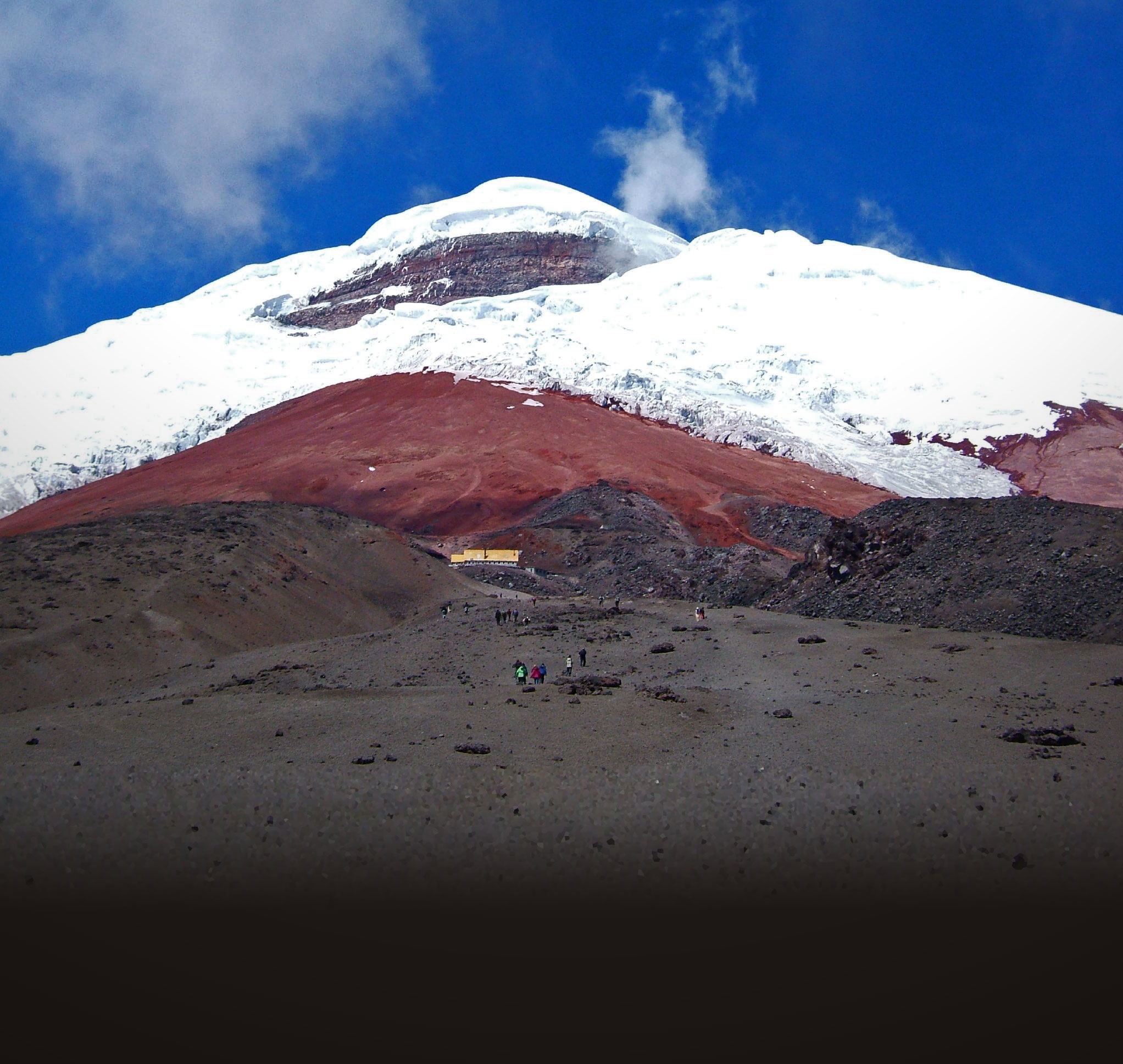
On day five we hiked up the Jose Rivas refuge on Cotopaxi, and then on to the Glacier.


Day 6
We returned to the glacier the following afternoon for training with our crampons and ice axes. As soon as we arrived, the snow started coming down, just 12 hours before we'd be making our attempt at the summit.


After an hour of training in the snow, we made our way back to the refuge for a few hours sleep.

The weather never cleared, but we set out as planned around 1 am. When we reached the glacier we put on our crampons, and our guide roped us together. He led the way toward the top as we crossed crevasses, ice formations, drifts, and ice flows. It was breathtaking scenery made even more imposing by the darkness and the weather. Walking through the landscape high on the mountain was like nothing we've ever seen before.
Reaching the summit of any mountain is only the halfway mark. In fact, it is on the descent that most accidents occur. As we continued our climb to the top, we realized that the weather was slowing us down, wearing us out, and putting our new ice-climbing skills to the test. We weren't making progress as quickly as we needed to. We talked to our guide, and decided that the safest choice was to turn around. It was a difficult decision. We had come so far and worked so hard, and the summit was less that 2,000 feet away, but we knew that it would be just as hard — if not harder — to get down as it was to get up. Certainly we wanted to reach the top, but we knew our ultimate goal had been to raise a lot of money for Love & Hope. With your help, we did that. Just because the weather threw a kink into our plans, it doesn't mean we had any less fun, or are any less greatful for what was accomplished.
Cotopaxi is still there, dominating the landscape around it. Perhaps someday we'll have another chance to reach the top.